![]()
|
July 18, 2002
|
|
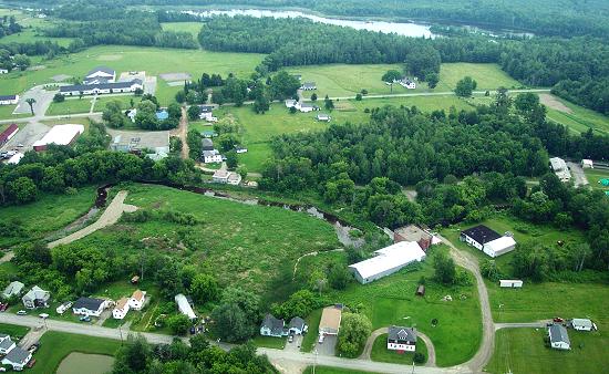
This aerial shows the area just downstream from Corinna village. Mill Street runs along the bottom of this photograph. The brick building on the river to the center-right is what's left of the Moosehead Woolen Mill. At the time that mill burned in 1950, it was the second largest woolen mill in Maine. It occupied the space back up along the river and into the wooded area. Following the river back to the left from the brick building along the trees, the first small structure, now a private home, was the mill office. The large open area partly encircled by the present river channel used to be the Lower Mill Pond held back by the dam at the lower mill. That dam was opened a few years ago. The long gravel roadway extending into the left of the former pond area was built by the EPA to allow drilling of test wells in that area as part of the investigation of the contamination there. |
![]()
Next | Previous | Homepage | Archive
![]()