![]()
|
Lately, in Corinna... May 16, 2001
|
 Last
night the EPA held a public meeting to review the work so far on the
Eastland Superfund Site and to give an overview of plans for the
future. Last
night the EPA held a public meeting to review the work so far on the
Eastland Superfund Site and to give an overview of plans for the
future.
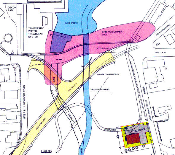
The diagram shows the main areas of work for this summer. The yellow portion represents roads sections that will be constructed from May to August, the new Route 7 through town and the extension of the Nokomis Road (West Main Street). These roads should be ready for traffic by early August. The pink section is called Area 1. It contains contaminated soil extending from the former location of the mill dye house and down river east to the underground storage tank location near the Dexter Road. Soon they will start removing soil on the east end and move west. The deepest contamination is on the west end of this area. That excavation will go down 30 to 40 feet, to bedrock. The blue line extending south is the new river channel going under the new bridge. Late this summer the East Branch of the Sebasticook River will be permanently diverted into the new channel. Click on the diagram to view a larger copy. |
![]()
Next | Previous | Homepage | Archive
![]()