The Mill Pond Shore Line
May 10, 2000
![]()
 Seen
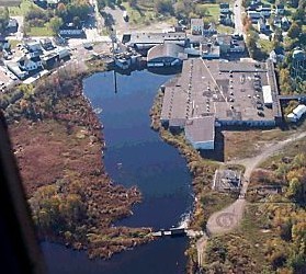
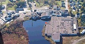
from the air, as in this picture taken before the demolition began, it
looked like the shoreline of the mill pond must have been changed to accommodate
the building of the back section of the mill. Seen
from the air, as in this picture taken before the demolition began, it
looked like the shoreline of the mill pond must have been changed to accommodate
the building of the back section of the mill.
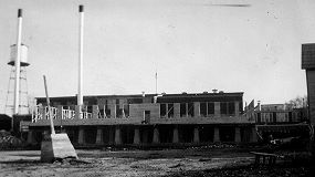
Below is a picture taken from behind the mill in about 1950 when the round-roof section was built. The concrete piling and pole on the left of the old photo was part of a cable system that ran from the mill to the upper dam. Years before, the cables carried by these poles, attached to a butterfly gate on the dam. This system allowed water flow from the dam to be controlled from a point at the back of the mill. |
| |
|
|
|
||
|
|
||
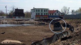
| The piling is beginning to break up. The remains of the pole are visible at the top. However, it is very large. I doubt it has moved much in the past 50 years. | 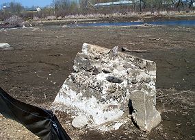 |
||
| |
|||
 |
The piling is located near the orange spot in the center of this picture. The mill pond must have been significantly changed when the back section was built. |
![]()
![]()